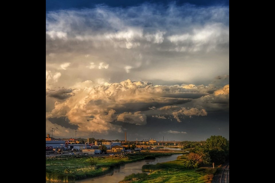
MOOSE JAW — The Facebook group Saskatchewan Storm Reports has seen a sharp rise in popularity this summer, and amateur photographers from across the province are contributing incredible shots of the wild, living skies the prairie is famous for.
Lynnden MacKenzie in Moose Jaw has always been fascinated by storms and has taken photos of them for years. Having somewhere to share her photos has been good for her, she said.
“I love it. I just posted my first pictures on there a couple of weeks ago. And every day I’m getting likes or loves and just reading the amazing comments and everything. I didn’t think it was going to be like that.”
Last year wasn’t very interesting weather-wise because of the drought, MacKenzie noted, so it’s been good to have more activity in 2022.
Something MacKenzie and other storm-chasers have noticed is the tendency of weather systems to curve around Moose Jaw and other larger population centres.
Meteorologist Natalie Hasell with Environment and Climate Change Canada (ECCC) said that while the climate is complicated and there are always multiple reasons for everything that happens, weather changing as it approaches a city is mostly about terrain, heat, and moisture.
“Rural areas typically have very small buildings, very sparse infrastructure, fields are often quite flat. There’s not a lot of friction or anything that’ll change the wind flow,” Hasell explained.
Air doesn’t move freely, but clumps together in cells depending on its temperature, humidity, altitude, and pressure, she said, so weather is the result of air masses moving around and bumping into each other — and into terrain features like hills, mountains, valleys, bodies of water, and clusters of buildings.
“Cities are also hotter, that’s called the urban heat island effect,” Hasell continued. “Mainly because of the materials that are used in cities, right? The asphalt, the cement, the concrete, that stuff doesn’t behave the same as agricultural land.”
The final component in the simplified explanation is that rainfall on rural land tends to not stick around unless the ground is saturated. In a city, puddled water doesn’t drain as quickly.
The total effect is to create cells of air over and around urban areas that can be very different from the surrounding area. Sometimes storms will bounce off of or split around that hotter, wetter, rougher air. Other times, storms get worse.
“Urban areas are not protected, exactly,” Hasell said. “The heat island effect is just one factor. There’s lots of stuff going on in the atmosphere.”
The tornado activity has been average this year, she added. It might seem worse because last year featured an extended heat dome with a drought and forest fires. Those conditions can generate strong winds, but less of the vertical, moisture-driven movements that create tornadoes and thunderstorms.
An interesting fact about such storms is that their severity can depend on how tilted they are, which has to do with wind shear.
The vertical arrangement of weather is crucial. Hasell calls it a 3D view. The first layer, the troposphere, is the most unstable. A storm beginning in that first layer, closest to the ground, will rise until it hits a more stable layer. If that layer isn’t moving, the vertical push will self-balance and the storm will dissipate.
If the layer a storm runs into on its way up is moving, however, the system spreads. The rising heat and moisture starts pushing at the cells on either side, resulting in a more severe storm. Add rotation, and you may even get a tornado.
Hasell cautioned storm-watchers to be careful, always have a shelter plan, and take the threat of lightning and strong winds seriously.
To stay up to date or contribute your own photography, find the group at facebook.com/groups/saskatchewanstorm.
For info on seasonal weather hazards, visit canada.ca/en/environment-climate-change/services/seasonal-weather-hazards.html.


